
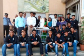


Accomplishments

Remote Sensing Image Fusion using Machine Learning and Deep Learning: A Systematic Review
- Details
- Share

- Abstract
-
 PDF Full Text
Modern Remote Sensing (RS) technologies have emerged and picked up a substantial momentum as a valuable source of data for environmental, economic, and social applications over the past few years. RS has given birth to few other beneficial processes like image fusion that extracts & registers relevant important knowledge from satellite images to make them more useful before subjecting to future applications. Image Fusion is typically performed with three broader techniques: Pixel level, Feature Level and Decision Level. With the help of proper image fusion methods, the concerned information is extracted from various images, which can then be utilized for everyday applications, ranging from weather forecasts to reports on natural disasters or climate change. This study talks about a practice of applying Artificial Intelligence (AI) to the great extent considering its recent advancement in the domain of image processing. In a nutshell, this paper explores and analyses the key remote sensing data fusion techniques based on Machine Learning and Deep Learning with respect to multi-satellite images and single satellite multi-spectral band images and reviews the theory, principles, applications, constraints, and benefits of each technique with a goal of discussing a potential future direction of this study.
Related Items
-
Admissions▲
▼
- Computer Engineering
- Electronics and Telecommunication
- Electronics Engineering
- Information Technology
- Artificial Intelligence
-
About▲ ▼
-
Student Help▲ ▼
- Quick Links▲ ▼
-
Get in Touch▲ ▼

-
K J Somaiya Institute of Technology
Somaiya Ayurvihar Complex, Eastern Express Highway, Near Everard Nagar, Sion (East), Mumbai – 400 022
91-22-44444408 / 44444403
info.tech@somaiya.edu -

